


Jalgaon District – Overview
Special Features
Jalgaon is famously known as the “Banana Capital” of India. Located in North Maharashtra (also known as Khandesh), the district holds unique geographic and cultural significance. It is home to tribal communities in the Satpuda mountain range, the Tapi River, a strong railway network, and progressive efforts in modern agriculture and irrigation.
Historically known as Khandesh, Jalgaon has witnessed several dynasties — from the Satavahanas to the Marathas and later the British. In 1906, Khandesh was split, forming East Khandesh, which later became Jalgaon district. In 1960, with the formation of the State of Maharashtra, Jalgaon was incorporated into it.
Geography
Jalgaon is situated in the northern part of Maharashtra, bordered by:
- North – Madhya Pradesh
- East – Buldhana
- South – Aurangabad
- Southwest – Nashik
- West – Dhule
The district’s agricultural progress is largely due to ample water resources. The Tapi River, originating in Madhya Pradesh, flows westward into the Arabian Sea — unlike most Indian rivers, which flow eastward. This makes it one of the few west-flowing rivers.
To promote irrigation and drinking water use, Jalgaon initiated an innovative river-linking project, which succeeded as a pilot project. The climate is dry and extreme, with cold winters and very hot summers. The Satpuda ranges to the north (bordering Madhya Pradesh) are rich in forest cover.
Local Governance
| S.No | Type of Local Body | Count | Names |
| 1 | Municipal Corporation | 1 | Jalgaon |
| 2 | Municipal Councils | 13 | Bhusawal, Amalner, Chalisgaon, Chopda, Pachora, Faizpur, Yaval, Raver, Savda, Parola, Dharangaon, Erandol, Jamner, Nashirabad. |
| 3 | Zilla Parishad | 1 | Jalgaon |
| 4 | Panchayat Samitis | 15 | Chalisgaon, Bhadgaon, Parola, Amalner, Chopda, Erandol, Jalgaon, Pachora, Jamner, Bhusawal, Yaval, Raver, Edalabad/Muktainagar, Bodwad, Dharangaon |
Cultural Significance
Jalgaon has been home to eminent personalities such as:
- Sane Guruji
- Balkavi Thombre
- Madhav Julian
- Bahinabai Chaudhari
- Swami Kuvalayananda
Notable cultural sites include:
- Amalner – Known as Maharashtra’s spiritual hub
- Erandol (ancient Ekchakranagar) – Persian inscriptions and Pandava lore
- Patan, Changdev, and Parola – Yadava-era sculptures
- Unapdev, Sunapdev, and Nazardeo – Natural hot springs
- Pal-Manudevi – A scenic and religious destination
- Faizpur – First rural session of the Indian National Congress (1936)
- Varkhedi Budruk – Symbol of common man’s resistance to British rule
General Information
Jalgaon is located in the northern region of Maharashtra, with Jalgaon city as the administrative headquarters. It borders Madhya Pradesh to the north, Buldhana to the east, Jalna and Aurangabad to the south, Nashik to the southwest, and Dhule to the west.
The district is surrounded by the Satpuda mountain ranges and is encircled by the Tapi River. It is the birthplace of the renowned rural poetess Bahinabai Chaudhari, whose Ahirani-language poems gained global recognition posthumously through her son’s publications. The Kaviyatri Bahinabai Chaudhari North Maharashtra University is named in her honor.
Jalgaon is also close to the Ajanta Caves and mountain ranges of global archaeological significance. It is a major market for cotton, bananas, pulses, and gold. The Tapi River flows westward into the Arabian Sea, unlike other rivers in the region.
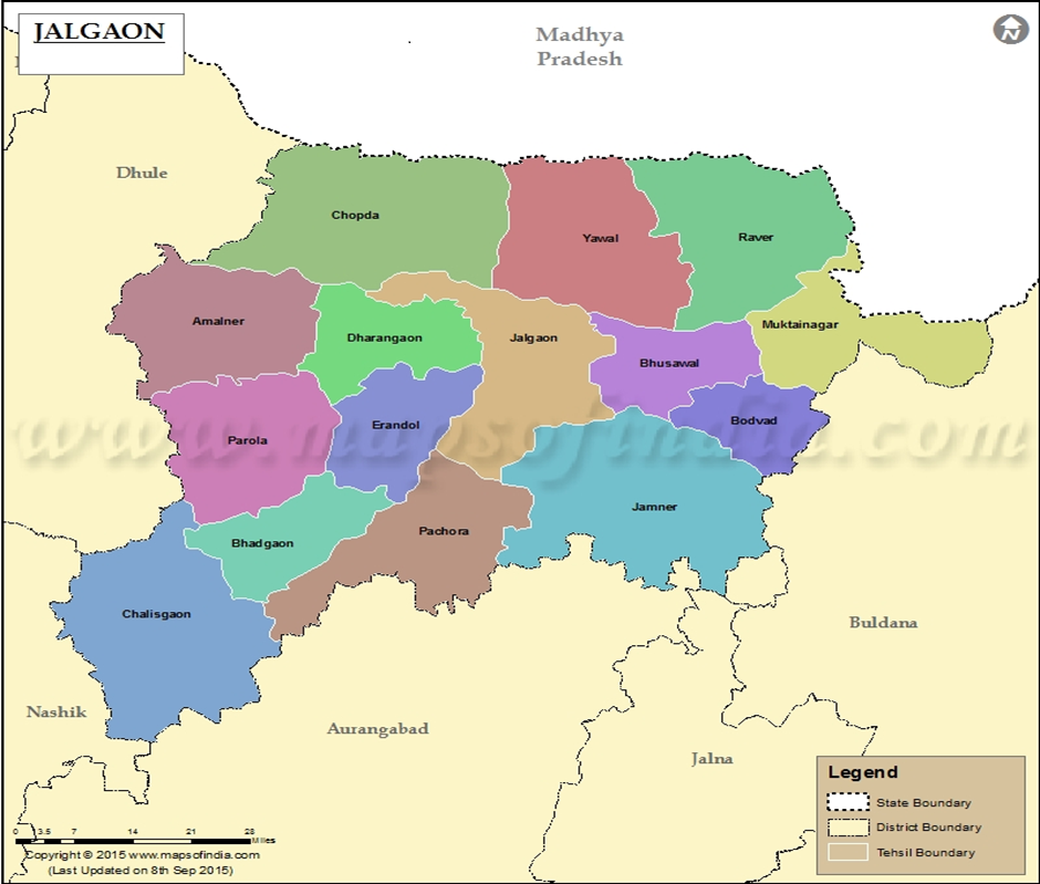
Talukas in Jalgaon District
Jalgaon comprises 15 talukas:
| Jalgaon | Amalner | Bhadgaon |
| Bhusawal | Bodwad | Chalisgaon |
| Chopda | Dharangaon | Erandol |
| Jamner | Muktainagar | Pachora |
| Parola | Raver | Yaval |
Transport
- National Highways: NH-161H, NH-161G
- NH-161G connects Patur–Balapur–Shegaon–Sangrampur–Jalgaon Jamod–Khaknar (M.P.)
- Khandevi–Kurha route connects to Muktainagar (via State Highway 195)
- State Highway 24: Sangrampur to Telhara
- Nearest Railway Station: Badnera, under Bhusawal Division of Central Railway
- Nearest Domestic Airport: Aurangabad (223 km)
- Nearest International Airport: Dr. Babasaheb Ambedkar International Airport, Nagpur (327 km)
Geographical Stats
- Population: 4,229,917
- Area: 11,765 sq. km
- Literacy Rate: 85%
- Sex Ratio: 933 females per 1000 males
- Major Highways: NH-6 and NH-211
- Primary River: Tapi (Total Length: 724 km; 208 km in Maharashtra)
- Other Rivers: Girna, Waghur
- Major Languages: Ahirani (local), Marathi, Khandeshi; Hindi is also spoken in areas bordering Madhya Pradesh
- Average Rainfall: ~700 mm annually
- Summer Temperature: Up to 45–48°C
- Winter Climate: Pleasant
Major Crops
- Banana
- Wheat
- Pearl Millet (Bajra)
- Lemon
- Groundnut
- Cotton
- Sugarcane
Traditional Fairs and Festivals
- Ram Rath Utsav in Kartik month
- Mahalakshmi Yatra during Navratri
- Changdev Yatra (6 km from Muktainagar)
- Muktai Yatra at Kotali in Muktainagar
Historical Background of Jalgaon District
Before October 21, 1960, Jalgaon district, formerly known as East Khandesh, was part of the larger region called Khandesh. According to Abul Fazl (Ain-i-Akbari, 1157 by Gladwin), the name Khandesh is believed to have been derived from the title “Khan” granted to Malik Nasir, a ruler under the Faruqi dynasty of Gujarat. Some sources also link the name to the Khandava forest mentioned in the Mahabharata.
Historical references from the Mahabharata mention a ruler of Toranmal (now in Nandurbar district) who fought alongside the Pandavas. The rock-cut caves in Nashik and Ajanta, dating back to the first three centuries AD, indicate that Khandesh was under the rule of Buddhist-patronizing kings.
Over time, the region was ruled by the Satavahanas, Andhrabhrityas, Ahir King Virsen, Yavanas, Chalukyas, Yadavas, followed by Alauddin Khilji, Muhammad Tughlaq, Malik Raja Malik Nazir, the Nizam of Hyderabad, and then the Marathas.
In the 18th century, Khandesh was captured by British forces under the Holkar rule, with Dhule as its headquarters. Mr. Robert Gill was the first British East India Company officer appointed in the district. In 1906, Khandesh was divided and East Khandesh became present-day Jalgaon. With the States Reorganization in 1956, it was merged into the Bombay State, and upon the formation of Maharashtra in 1960, Jalgaon became a district of the new state.
Important Historical Highlights
- Parola Tehsil: Contains remains believed to be linked to the father of the great Queen of Jhansi.
- 1936: Faizpur in Yawal tehsil hosted the first rural session of the Indian National Congress.
- Bahinabai Chaudhari, a renowned local poetess, brought fame to the Ahirani dialect through her poems.
- Sane Guruji awakened the working class, and Balkavi Thombre’s poetry enriched the district’s socio-cultural life.
Mythological & Medieval References
- Burhanpur was the capital of Khandesh, which once had 300 administrative divisions (Parganas).
- Asirgarh is a historical fort tied to the region’s ancient past.
- The Girna River, once called Giriparna, is mentioned in 10th-century copper plate inscriptions.
- Khandesh was once a major textile trading hub, producing fine fabrics exported to Persia, Turkey, and Arabia.
Ramayana & Mahabharata Connections
- Padmalaya (Erandol): Site where Bhima is believed to have killed Bakasura.
- Unapdev and Sunapdev: Hot water springs said to have been created by Lord Rama’s arrows.
- Edalabad (now Muktainagar): Believed to be where King Dasharatha performed penance after the accidental killing of Shravan Bal. The sacred lake here has been used for irrigation since the 16th century.
Cultural Legacy
- Jalgaon has deep roots in history and mythology, with several villages like Amalner, Bahal, Bhadgaon, Pachora, Shendurni, Erandol, and others mentioned in Mughal-era records.
- Ancient copper plate inscriptions from Vajirkhede (Malegaon Taluka) mention the Girna River as “Giriparna,” with dating attributed to 915 AD by poet Rajeshwar.
Trade & Economy in Historic Khandesh
Between 1656 and 1717, Niccolao Manucci, a Venetian traveler and Mughal court official, visited Khandesh multiple times and documented it extensively. He wrote that Burhanpur was a flourishing center for fine fabrics, scarves, and veils. Persian and Armenian merchants frequently visited the region to trade white muslin, printed cloths, and other high-quality textiles.